Take On Big Bend National Park like a Pro

Image: roamer.rat/Shutterstock.com
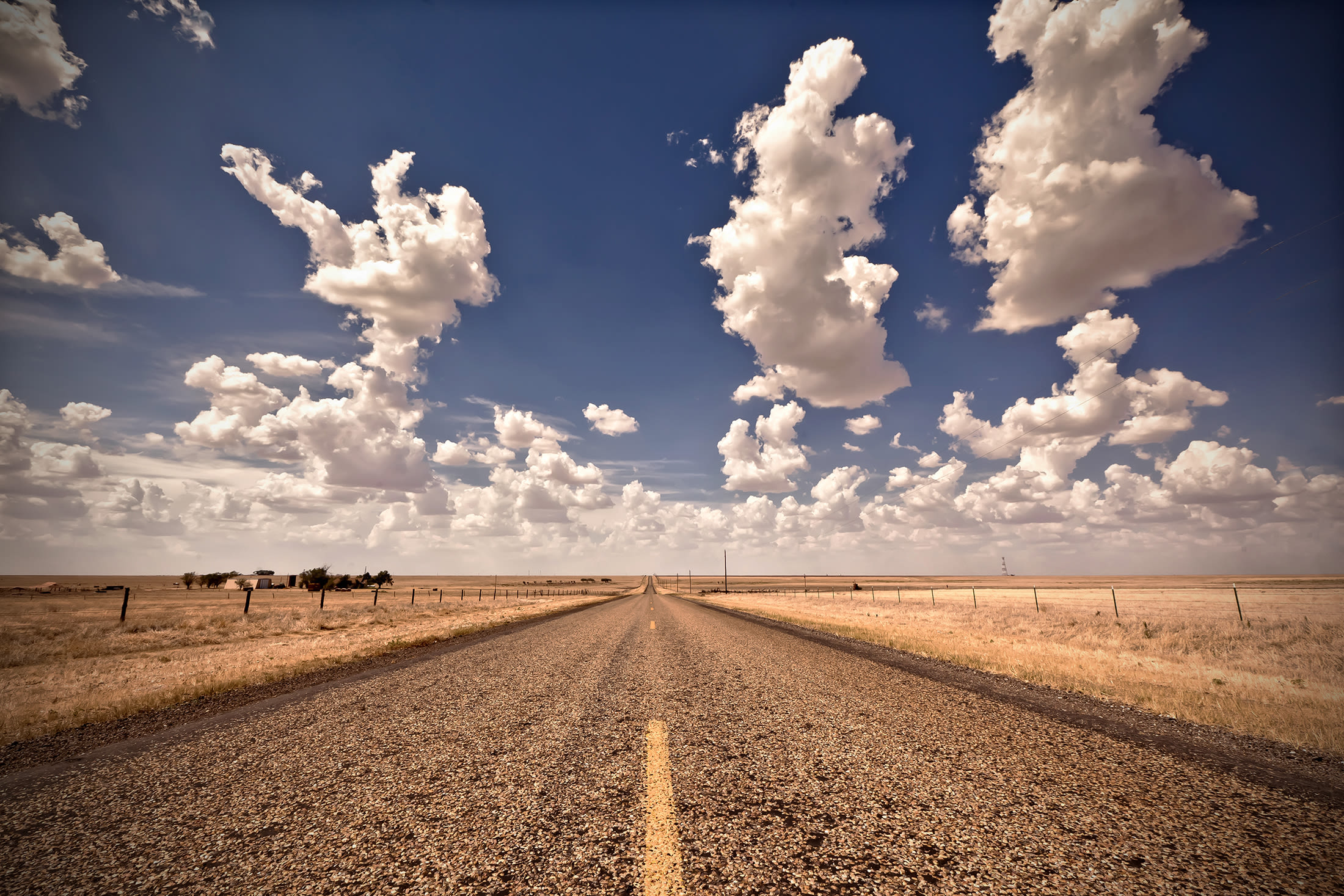
Anyone who lives in Texas probably has Big Bend National Park on their bucket list. For us Houstonians, it’s about a nine-hour drive, without stops or traffic, but the park’s beauty is so worth it.
If you take the advice from our road trip guide, you’ll know it’s fun to take I-10 to stop in places like Sonora and Fort Stockton before using US Route 385 through Marathon to reach the park. The drive is gorgeous, but because of the nature of it—you’re literally in the Wild West—you will lose cell service many times. Be ready to send text messages via satellite, and have plenty of songs and podcasts downloaded to make the drive easier.
The park, sometimes referred to as “Texas’s gift to the nation,” is home to archeological sites, old mining operations and ranches, trails, wildlife, the Rio Grande (a bend in the river gives the park its name), and the Santa Elena Canyon. In the 1930s, people who had settlements in the area realized it was worth preserving for future generations. Known at first as the Texas Canyons State Park, it officially earned the title of Big Bend National Park in 1944.
With all its history and beauty, it’s so much more than just a spot to unplug from our busy Houston life. Here’s what you need to know before you go.

Heads Up
Visitors can pay the seven-day entrance fee at the front of the park or through a visitor’s center—Panther Junction is open year-round, while Rio Grande Village, Persimmon Gap, and Castolon centers are open November through April. Private, noncommercial vehicles cost $30, motorcycles are $25, and individuals without a vehicle must pay $15. There’s also an option for a $55 annual pass.
On my recent visit, I was lucky enough to experience the Chisos Mountains Lodge before its two-year hiatus that begins this summer (sorry, y’all!). Built in 1964, it’s currently the only place to stay in the park for people like me who don’t want to rough it with camping. Thanks to the Great American Outdoors Act, which provides funding for recreational opportunities in national parks, it will undergo a major $22 million facelift.
Over the years the building has suffered from major damage to its foundation, roof, walls, windows, and building systems, making maintenance unsustainable. The current structure will be demolished then rebuilt using stucco, natural stone, and fire-resistant siding. The goal is to construct the lodge within the footprint of its existing buildings. Other updates include the replacement of aged waterlines to help thirsty visitors as well as the park’s plants and wildlife.
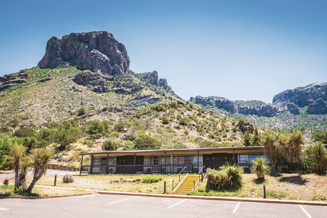
Image: Sandra Foyt/Shutterstock.com
Once completed, the new lodge will feature an angled roof with solar panels, an expansive outdoor terrace and reception area, a new retail store selling gifts and camping essentials, and grab-and-go food service. For now, though, due to the construction the Chisos Basin portion of the park will be completely closed off to visitors.
In the meantime, the park’s staff encourage visitors to stay at Big Bend Station in Terlingua, which offers standard rooms, suites, and an RV and campground area. There are also many other glamping and lodging options outside of the park, so you’re bound to find something that checks all your boxes. Fingers crossed for speedy construction, though.
Trails on Trails
Once the Chisos Basin reopens, I recommend hiking the Window Trail and Lost Mine Trail. Although both are considered moderate in terms of difficulty, prepare yourself for a literal uphill battle. As always, the views make it all worthwhile.
There are many other opportunities for exploration within Big Bend National Park that fall outside of the basin. The park will still have over 800,000 acres and 150 miles of hiking trails open to the public, and other developed campgrounds available at the Rio Grande Village and Cottonwood Campground.
The Ross Maxwell Scenic Drive will remain accessible during the two-year project. This 30-mile route shows you the geological structures the park is famous for, while also allowing you to park and conquer some trails along the way.

Image: Zack Frank/Shutterstock.com
My first stop on this drive was a walk around the Sam Nail Ranch. Once an active homestead, it’s since been overtaken by nature and wildlife. You can still see remnants of what it once was and get a glimpse of a singular windmill that still pumps water today. My next stop was the Mule Ears Viewpoint to see the two peaks, from which you can tack on the 3.8-mile Mule Ears Spring Trail. I also stopped to see Tuff Canyon, so named because it’s carved out of soft volcanic tuff—or compressed ash. The 0.5-mile Tuff Canyon Trail has three viewing platforms and takes about 20 minutes to complete.
The Ross Maxwell route also includes the Castolon Historic District, with an active visitor center and shop. The area showcases a region where settlers once formed a bicultural community, blending Mexican and American cultures. A drive over to the Santa Elena Canyon puts into perspective just how close the border is: The canyon’s right side is US soil, and the left is Mexico. On the Santa Elena Canyon Trail (1.6 miles round trip), beware that you must first cross the bed of Terlingua Creek and climb a steep bank, so it can be difficult depending on the conditions. Park rangers warn it’s often impassible during rainy weather.
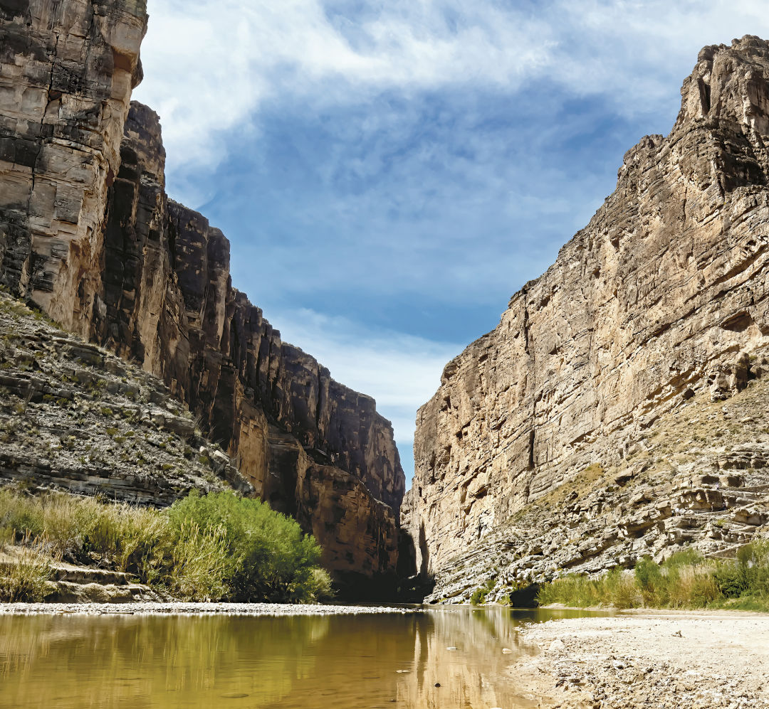
Image: PVminer2/Shutterstock.com
The scenic drive has a couple of longer but still moderate hikes, including the Upper Burro Mesa Pouroff Trail (3.5 miles) and the Chimneys Trail (4.8 miles). Be sure to pack plenty of water—about a liter is recommended per person—and do your research on the types of animals you might see.
Throughout my time in the park, I was warned the most about black bears and mountain lions. If you do encounter them, you should never run, but instead back away and get out of range. If you feel like you’re being threatened, stand large, wave your arms, and make commotion by throwing rocks or sticks. Don’t let this possibility deter you, though. I promise the only “wildlife” I encountered was a (not-wild) German shepherd named Jax.
I also explored the Fossil Discovery Exhibit, per the recommendation of a couple of park rangers. It’s not on the scenic drive but is accessible through the Persimmon Gap Entrance Road. This self-guided experience shows you the evolution of the park, as well as fossils and life-size replicas of some prehistoric creatures. Did you know that 100 million years ago the park resembled the coastline of the Maldives? That’s insane to think about given how dry it is now, and that was just one of many mind-blowing facts I learned while touring the exhibition.
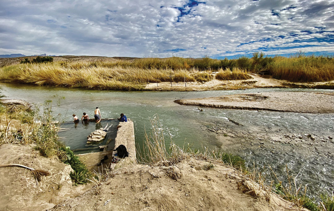
One of Big Bend National Park’s crown jewels, of course, is the Rio Grande. Several trails labeled as easy or moderate allow you to hike alongside it, like the Hot Springs Historic Trail (1 mile) and the Boquillas Canyon Trail (1.4 miles). If you plan ahead, you can take a guided rafting trip from a local outfitter. Think you can take the river on by yourself? Be our guest, but don’t forget that a backcountry use permit is needed, and there are requirements for specific gear for day-use and overnight trips. And beware: You might be met with a struggle due to ongoing drought conditions.
It’s worth mentioning that despite the federal cuts to the National Park Service under the current administration, I still found plenty of workers who were ready to help visitors during my April trip. Although I would’ve loved at least 24 more hours to experience more of the park, I still fit a lot into my two days. This city girl was mesmerized by the mountains, wildlife, and vastness of undeveloped land. But knowing what I know now, I have some words of advice. One: Carve out three full days to a week if you want to truly experience the beauty of it all. And two: Take a bigger car than a Kia Optima so you can explore the unpaved dirt roads for more of an adventure.